Project history
GeotIS - a joint venture
Since its launch in 2006, the GeotIS geothermal information system has been continuously developed in various projects by LIAG and a large number of partners. At this place we would like to give you a brief overview of the projects so far and the institutions involved.
And if you are interessed in the persons behind GeotIS you are invited to visit our Team-site.
Previous and current projects

GRETA (2024-2027)
Reference number: 37EV211010
The GRETA project aims to quantitatively record and map the potential of deep, medium-depth, and shallow geothermal energy in Germany based on various utilization concepts.
THC-Prognos (2023-2026)
Reference number: 03EE4056E
Hydrochemical characterization for prognostic modeling of sustainable reservoir management; sub-project: Expansion of Germany's geothermal information system GeotIS to include fluid chemical data.

Warm-Up (2022-2027)
Reference number: 03EE4049B
Supporting the rollout of medium-depth geothermal energy in Germany; sub-projects: Verification of evaluation criteria according to the PlayType concept, exploration seismics, and knowledge transfer via GeotIS

WärmeGut (2022-2025)
Reference number: 03EE40446
With WärmeGut, an extension of GeotIS to information about the entire geothermal energy including near-surface geothermal energy is to be implemented.

ArtemIS (2021-2025)
Reference number: 03EE4024
ArtemIS updates the geothermal information system GeotIS and extends it to include medium-depth geothermal energy.

GeoFaces (2016-2019)
Reference number: 0324025A
In addition to the preparation and evaluation of geological, geophysical and hydraulic data on deep aquifers, this project ("Characterization of Geothermal Resources in Due Consideration of Boundary Layers and Joint Faces") focuses on boundary layers and joint faces. Boundary layers mark changes in sedimentary environments, e. g. the transition from erosion to deposition. They may result in conclusions about subjacent reservoirs. Joint faces are fissures and cleavages of rock bodies that affect the permeability as well as the geochemical evolution of reservoirs.
Furthermore, new structural 3D models will be created and implemented in the geothermal information system GeotIS. With the development of an interactive e-learning portal this project will turn over a new leaf in geothermal education.

StörTief (2013-2016)
Reference number: 0325623A
Deep reaching faults gain in importance in geothermal exploration in Germany. Fault zones have emerged as prominent drilling targets for the exploitation of hydrothermal resources in the pursuit for higher production rates (e. g. in the Upper Rhine Graben and the Molasse Basin). This is the rational ground why fault zones were attributed and linked with a scientific literature data base in the project "The Role of Deep Reaching Fault Zones for Geothermal Energy Utilization" which was funded by the Federal Ministry of Economic Affairs. In addition, two new structural 3D models were created and the structural model "GeoPower" of Schleswig-Holstein was implemented in the geothermal information system GeotIS.
Geothermieatlas (2010-2013)
Reference number: 0325257A/B
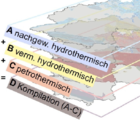
In its coalition agreement of the 17th legislature, the Federal Government of Germany has decided to commission a geothermal atlas to view potential competition between CO2 storage and deep geothermal energy. The utilization potentials for both options were presented together on four maps on a scale of 1: 1,000,000. Hydrothermal and petrothermal systems were evaluated individually according to their geothermal potential and future availability. In addition, information on deep reaching fault systems were compiled in a national survey. However, further criteria should be taken into account for a comparative evaluation of the two options and a possible designation of preferential areas. Detailed feasibility studies are also required in individual cases. The maps have been integrated into GeotIS and are available for download.

GeotIS II (2009-2013)
Reference number: 0327542A
The geothermal information system GeotIS was extended in the project "Internet Based Information Centre for Geothermal Energy Usage", which was funded by the Federal Ministry for the Environment and Nuclear Safety. In the course of this project available data stocks for hydrothermal resources in Germany were retrieved, extended and connected to data bases. 3D structural models were extended and completed. A 3D model of Hesse was included, showing the geothermal potential of the northern part of the Upper Rhine Graben. The 3D temperature models were expanded to cover all of Germany.

GeoTool (2009-2013)
Reference number: 0325136
In the course of the GeoTool project the environment department of the Regional Council of Freiburg (RPF) developed methodic concepts for site-specific assessments of subsurface parameters that are relevant for the evaluation of the probability of success of geothermal projects. The objective was an investigation of those regions of the Upper Rhine Graben and the Molasse Basin that are located in Baden-Wuerttemberg. Considerable hydraulic, hydrochemical and thermal data for various geothermal target horizons were compiled and analyzed for both study areas. Especially the estimation of subsurface hydraulic conductivities gained in importance. The data stock was complemented by qualitative or half-qualititative information that could be used to draw conclusions on the conductivity (e. g. fissuring, porosity, fault zone).

GeotIS (2006-2009)
Reference number: 0327542
The office for the assessment of technology consequences of the German parliament suggested the compilation of an atlas of geothermal resources (TAB, 2003). As a result, the Federal Ministry for the Environment and Nuclear Safety funded the project "Setup of a Geothermal Information System for Germany" (GeotIS) from 2006 to 2009 which focused on deep aquifers in the eastern part of the North German Basin, the Upper Rhine Graben and the Molasse Basin in the south of Germany. Even in this initial phase, two structural 3D models and two 3D temperature models were built.


 Sprache zu Deutsch wechseln
  Continue in English